Error message
Notice: Trying to access array offset on value of type null in IslandoraSolrDisplayManagerResults->currentQueryDisplays() (line 222 of /var/www/drupal7/sites/all/modules/islandora_solr_display_manager/includes/islandora_solr_display_manager.inc).
-
-
Title
-
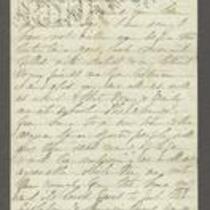
From Sara Robinson to "My Dear Martha"
-
Description
-
This letter, dated October 19, 1862, is from Sara Robinson in Topeka, Kansas to Martha. Sara reports that her husband, Kansas Gov. Charles Robinson, went to Altoona, Pennsylvania to meet "the Governors," but by the time he arrived they had already gone to Washington, D.C. Charles "had no wish to see the Sec. of War or the President, both of whom have treated him & the young state of Kansas so villainously & did not follow them." Sara states that when Charles returned, he went to St. Louis to see Gen. Curtis.
-
Object Type
-
Letter
-
Date
-
October 19, 1862
-
-
Title
-
From G.W. Veale to George W. Dietzler
-
Description
-
On October 30, 1864, this dispatch was sent by Col. G.W. Veale at Headquarters, 2nd Regiment, Kansas State Militia in Topeka, Kansas, to Maj. Gen. Dietzler, Comm. Kansas State Militia. Veale reports on a recent campaign in which his regiment moved from Topeka to Shawneetown in Johnson County, Kansas, to Jackson County, Missouri, where it fought in the Battle of the Blue on October 22, 1864. Veale states that his regiment lost 44 killed and wounded, with 68 men taken prisoner after fighting “a force six times our number for three quarters of an hour.” The dispatch includes a list of the soldiers killed and wounded in the battle.
-
Date
-
October 30, 1864
-
-
Title
-
From Edward Fitch to Dear Parents
-
Description
-
Edward Fitch of Lawrence, Kansas, writes a letter to his parents in Massachusetts on August 9, 1857, announcing that Kansas has voted to ratify the Topeka Constitution. He adds that Free State supporters appear to comprise a majority in Kansas. Fitch complains about a recent Herald of Freedom article on the apportionment of the Kansas Legislature, and claims that it is “the most damning piece of villany ever perpetrated by any men or set of men.”
-
Date
-
August 9, 1857
-

-
Title
-
Sectional Map of Kansas Territory
-
Description
-
This color map, dated April 1857, is entitled "Sectional Map of Kansas Territory." It was drafted by C.P. Wiggin and signed by L.A. MacLean, Chief Clerk of the Surveyor General’s office in Lecompton, Kansas Territory. MacLean certifies that the map was compiled from U.S. survey field notes. The map was published by MacLean and Lawrence and printed by William Schuchman and Bro. in Philadelphia.
-
Object Type
-
Map
-
Date
-
April 1857
-

-
Title
-
New Sectional Map of Kansas
-
Description
-
This color map, drafted in 1859 by Robert L. Ream, was published by Stevenson and Morris of St. Louis, and printed by A. Janicke and Co. of St. Louis. The map is entitled “New Sectional Map of Kansas,” and was compiled from the field notes in the Surveyor General’s office.
-
Object Type
-
Map
-
Date
-
1859
-

-
Title
-
Map Showing the Progress of the Public Surveys in the Territories of Kansas and Nebraska
-
Description
-
This black-and-white map, signed by Ward B. Burnett, Surveyor General, was issued by the Surveyor General’s office in Nebraska City, Nebraska Territory on October 1, 1860. The map shows the progress of the public surveys in the territories of Kansas and Nebraska, and was produced to accompany the Surveyor General’s 1860 annual report.
-
Object Type
-
Map
-
Date
-
October 1, 1860
-

-
Title
-
Map Showing the Progress of the Public Surveys in the Territories of Kansas and Nebraska
-
Description
-
This black-and-white map, signed by Ward B. Burnett, Surveyor General, was issued by the Surveyor General’s office in Nebraska City, Nebraska Territory on October 1, 1859. The map shows the progress of the public surveys in the territories of Kansas and Nebraska, and was produced to accompany the Surveyor General’s 1859 annual report.
-
Object Type
-
Map
-
Date
-
October 1, 1859
-

-
Title
-
Map Showing the Progress of the Public Surveys in Kansas and Nebraska
-
Description
-
This black-and-white map, signed by Mark W. Delahay, Surveyor General, was issued by the Surveyor General’s office in Leavenworth, Kansas on September 2, 1861. The map shows the progress of the public surveys in Kansas and Nebraska, and was produced to accompany the Surveyor General’s report of 1861.
-
Object Type
-
Map
-
Date
-
September 2, 1861
-

-
Title
-
Map Showing the Progress of the Public Surveys in the Territories of Kansas and Nebraska
-
Description
-
This black-and-white map, signed by J. Calhoun, Surveyor General, was issued by the Surveyor General’s office in Lecompton, Kansas Territory in October 1857. The map shows the progress of the public surveys in the territories of Kansas and Nebraska, and was produced to accompany the Surveyor General’s 1857 annual report.
-
Date
-
October 1857
