Error message
Notice: Trying to access array offset on value of type null in IslandoraSolrDisplayManagerResults->currentQueryDisplays() (line 222 of /var/www/drupal7/sites/all/modules/islandora_solr_display_manager/includes/islandora_solr_display_manager.inc).
-

-
Title
-
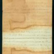
From Charles Adair to Samuel Lyle Adair, Florella Brown Adair, Emma Adair, and Ada Adair
-
Description
-
On December 10 and 13, 1862, Charles Adair writes from Rays Mill and Cane Hill, Arkansas, to his parents Florella Brown Adair and Samuel Lyle Adair, and sisters Emma and Ada Adair. Charles reports that he was involved in a “hard battle” at Boonesboro, Arkansas on November 28, and provides a brief account of the fighting. He also describes the Battle of Prairie Grove, in which his regiment fought on December 7. Charles says that they are given enough clothing and food in the army, but “I have suffered dreadfully for the want of sleep.”
-
Date
-
December 10, 1862-December 13, 1862
-
-
Title
-
From Leigh R. Webber to "Senorita Morena"
-
Description
-
This letter, dated April 30, 1862, is from Leigh R. Webber in "Camp of the Kansas First" to "Senorita Morena" (Miss Brown). Webber says his regiment is comfortably situated, and declares, "Fort Riley is not to be slurred at. It beats Fort Leavenworth all hollow, and Fort Scott is nowhere beside it." He reports that "We had a general inspection on Monday, and were mustered this forenoon," and adds that the soldiers will soon receive new equipment and arms.
-
Object Type
-
Letter
-
Date
-
April 30, 1862
-

-
Title
-
Map Showing the Progress of the Public Surveys in the Territories of Kansas and Nebraska
-
Description
-
This black-and-white map, signed by Ward B. Burnett, Surveyor General, was issued by the Surveyor General’s office in Nebraska City, Nebraska Territory on October 1, 1858. The map depicts the progress of the public surveys in Kansas and Nebraska in 1858, and was created to accompany the Surveyor General's report of that year. The map was printed by C.B. Graham Lithographers in Washington, DC.
-
Date
-
October 1, 1858
-

-
Title
-
Map Showing the Progress of the Public Surveys in the Territories of Kansas and Nebraska
-
Description
-
This black-and-white map, signed by J. Calhoun, Surveyor General, was issued by the Surveyor General’s office in Lecompton, Kansas Territory in October 1857. The map shows the progress of the public surveys in the territories of Kansas and Nebraska, and was produced to accompany the Surveyor General’s 1857 annual report.
-
Date
-
October 1857
