
The missouri-kansas conflict 1854-1865
Error message
Notice: Trying to access array offset on value of type null in IslandoraSolrDisplayManagerResults->currentQueryDisplays() (line 222 of /var/www/drupal7/sites/all/modules/islandora_solr_display_manager/includes/islandora_solr_display_manager.inc).


Object Type
- Map (4)
- Diary (1)
- Government Document (1)
- Legal Document (1)
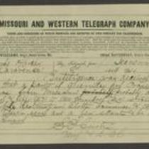
- Telegram (1)
Local Subject
- Bleeding Kansas, Bloodletting Missouri (7)
- American Indians (4)
- Guerrillas (4)
- Picturing the War (4)
- Bogus Legislature (2)
- Border Ruffians (2)
- Popular Sovereignty (2)
- Battle for Missouri, 1861-1865 -- Military History of Missouri and Kansas (1)
- Bushwhackers (1)
- Kansas-Nebraska Act (1)
People
- A. Danford (1)
- A. Janicke and Co. (Lithographer) (1)
- Andrew Reeder (1)
- Grand Jury, 1st District Court, Douglas County, Kansas (1)
- J.Bien (Lithographer) (1)
- J.G. Wells (Lithographer) (1)
- James W. Denver (1)
- John Brown (1)
- John Calhoun (1)
- John Halsall (1)
- Owen C. Stewart (1)
- Robert B. Mitchell (1)
- Robert L. Ream (1)
- Samuel M. Satters (1)
- Samuel R Curtis (1)
- Samuel R. Curtis (1)
- Stephen A Douglas (1)
- Stevenson and Morris (1)
- Theodore Garrett (1)
- Thomas E Ewing (1)
- Thomas Ewing, Jr. (1)
- William Weer (1)
Geographic Subject
- Douglas County, Kansas (8)
- Lawrence, Kansas (8)
- Fort Leavenworth, Kansas (5)
- Leavenworth County, Kansas (5)
- Lecompton, Kansas (5)
- Shawnee County, Kansas (5)
- Topeka, Kansas (5)
- Atchison County, Kansas (4)
- Bourbon County, Kansas (4)
- Doniphan County, Kansas (4)
- Fort Scott, Kansas (4)
- Leavenworth, Kansas (4)
- Linn County, Kansas (4)
- Atchison, Kansas (3)
- Franklin County, Kansas (3)
- Kansas City, Missouri (3)
- Buchanan County, Missouri (2)
- Jackson County, Kansas (2)
- Jackson County, Missouri (2)
- St. Joseph, Missouri (2)
- Weston, Missouri (2)
- Wyandotte County, Kansas (2)
- Andrew County, Missouri (1)
- Atchison County, Missouri (1)
- Bates County, Missouri (1)
- Brown County, Kansas (1)
- Carroll County, Missouri (1)
- Cass County, Missouri (1)
- Chariton County, Missouri (1)
- Clay County, Missouri (1)
- Dekalb County, Missouri (1)
- Harrison County, Missouri (1)
- Henry County, Missoui (1)
- Holt County, Missouri (1)
- Jefferson County, Kansas (1)
- Johnson County, Missouri (1)
- Linn County, Missouri (1)
- Mercer County, Missouri (1)
- Miami County, Kansas (1)
- Nodaway County, Missouri (1)
- Osage County, Kansas (1)
- Platte County, Missouri (1)
- Quindaro, Kansas (1)
- Ray County, Missouri (1)
- Shawnee Mission, Kansas (1)
- Vernon County, Missouri (1)