Error message
Notice: Trying to access array offset on value of type null in IslandoraSolrDisplayManagerResults->currentQueryDisplays() (line 222 of /var/www/drupal7/sites/all/modules/islandora_solr_display_manager/includes/islandora_solr_display_manager.inc).
-
-
Title
-
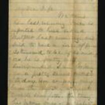
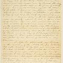
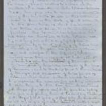
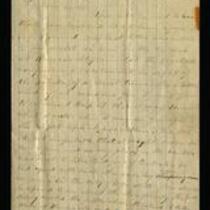
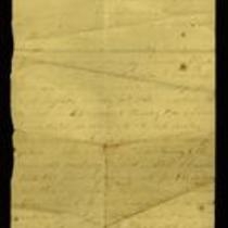
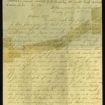
From James Griffing to My Dear Wife
-
Description
-
This letter, dated October 23, 1864, was written by James Griffing in camp at Kansas City, Missouri, to his wife. James provides an account of “a tremendous battle about five miles south of this” (presumably the Battle of Westport), which he heard about via dispatches from the battlefield. James includes an assessment of the Union casualties from regimental surgeon Dr. Hidden: “he thought but few cases would prove fatal.”
-
Object Type
-
Letter
-
Date
-
October 23, 1864
-
-
Title
-
From G.W. Veale to George W. Dietzler
-
Description
-
On October 30, 1864, this dispatch was sent by Col. G.W. Veale at Headquarters, 2nd Regiment, Kansas State Militia in Topeka, Kansas, to Maj. Gen. Dietzler, Comm. Kansas State Militia. Veale reports on a recent campaign in which his regiment moved from Topeka to Shawneetown in Johnson County, Kansas, to Jackson County, Missouri, where it fought in the Battle of the Blue on October 22, 1864. Veale states that his regiment lost 44 killed and wounded, with 68 men taken prisoner after fighting “a force six times our number for three quarters of an hour.” The dispatch includes a list of the soldiers killed and wounded in the battle.
-
Date
-
October 30, 1864
-
-
Title
-
Statement of Wilson Shannon
-
Description
-
This statement by Kansas Gov. Wilson Shannon was written ca. December 1855. Shannon describes the series of events leading to the Wakarusa War, beginning with the murder of a Free State supporter named Charles Dow by Franklin Coleman, a proslavery man. To address the subsequent civil unrest in Douglas County, Kansas, Shannon asks General Richardson, General Strickler, and Col. Sumner to supply troops and assist Douglas County Sheriff Samuel J. Jones in restoring order.
-
Object Type
-
Government Document
-
-
Title
-
From James Griffing to Cuttie
-
Description
-
This October 30, 1864 letter was written by James Griffing in Lincoln, to Cuttie. James describes General Price’s capture of the arsenal at Topeka, declaring “The Topeka boys fought like tigers.” He gives an account of acquaintances killed in the Battle of Westport, adding that he believes “Missouri will be safer now.” He cautions Cuttie not to buy much at current prices, since “everything is bound to change after the election.”
-
Date
-
October 30, 1864
-

-
Title
-
Nebraska and Kanzas
-
Description
-
This color map, ca. 1854-1861, is entitled “Nebraska and Kanzas.” It was printed by J.H. Colton and Co. in New York.
-
Object Type
-
Map
-
Date
-
1854-1861
-
-
Title
-
From A.J. Huntoon to Lizzie P. Huntoon
-
Description
-
In this letter, dated July 17 and July 20, 1861, A.J. Huntoon writes to his wife Lizzie P. Huntoon. On July 17, A.J. writes from Camp Lincoln, headquarters of the 3rd Regiment, Kansas Volunteers, in Fort Leavenworth, Kansas. A.J. describes his trip from Topeka to Fort Leavenworth, stating that four companies are in camp there, while another five have gone to Kansas City. On July 20, A.J. reports he is in camp at Kansas City, where there are rumors of an imminent secessionist attack; he believes there is no great danger.
-
Date
-
July 17, 1861-July 20, 1861
-

-
Title
-
New Sectional Map of Kansas
-
Description
-
This color map, drafted in 1859 by Robert L. Ream, was published by Stevenson and Morris of St. Louis, and printed by A. Janicke and Co. of St. Louis. The map is entitled “New Sectional Map of Kansas,” and was compiled from the field notes in the Surveyor General’s office.
-
Object Type
-
Map
-
Date
-
1859
-
-
Title
-
From A.J. Huntoon to My Dear Wife
-
Description
-
A.J. Huntoon writes a letter from Williamsport in Shawnee County, Kansas to his wife Lizzie, reporting that Rebels have fired at U.S. troops in Independence, Missouri. He adds that hundreds of Kansas troops have left Lawrence and Fort Leavenworth to assist U.S. troops in Kansas City and St. Joseph, Missouri. The letter, dated June 16 and 19, 1861, also mentions recent shootings in Leavenworth and Atchison, Kansas. Huntoon writes, “We may look for these as common occurrences in Kansas, for a while at least. All carry arms now . . . Men are paying out their last cent for them.”
-
Date
-
June 16, 1861-June 19, 1861
-

-
Title
-
Sectional Map of the Territory of Kansas
-
Description
-
This color map, entitled “Sectional Map of the Territory of Kansas,” was compiled from the field notes in the Surveyor General’s office. It was published in 1857 by John Halsall in St. Louis.
-
Object Type
-
Map
-
Date
-
1857
-

-
Title
-
Map Showing the Progress of the Public Surveys in the Territories of Kansas and Nebraska
-
Description
-
This black-and-white map, signed by Ward B. Burnett, Surveyor General, was issued by the Surveyor General’s office in Nebraska City, Nebraska Territory on October 1, 1860. The map shows the progress of the public surveys in the territories of Kansas and Nebraska, and was produced to accompany the Surveyor General’s 1860 annual report.
-
Object Type
-
Map
-
Date
-
October 1, 1860
-

-
Title
-
Map Showing the Progress of the Public Surveys in the Territories of Kansas and Nebraska
-
Description
-
This black-and-white map, signed by Ward B. Burnett, Surveyor General, was issued by the Surveyor General’s office in Nebraska City, Nebraska Territory on October 1, 1859. The map shows the progress of the public surveys in the territories of Kansas and Nebraska, and was produced to accompany the Surveyor General’s 1859 annual report.
-
Object Type
-
Map
-
Date
-
October 1, 1859
-

-
Title
-
Map Showing the Progress of the Public Surveys in Kansas and Nebraska
-
Description
-
This black-and-white map, signed by Mark W. Delahay, Surveyor General, was issued by the Surveyor General’s office in Leavenworth, Kansas on September 2, 1861. The map shows the progress of the public surveys in Kansas and Nebraska, and was produced to accompany the Surveyor General’s report of 1861.
-
Object Type
-
Map
-
Date
-
September 2, 1861
-

-
Title
-
Map Showing the Progress of the Public Surveys in the Territories of Kansas and Nebraska
-
Description
-
This black-and-white map, signed by J. Calhoun, Surveyor General, was issued by the Surveyor General’s office in Lecompton, Kansas Territory in October 1857. The map shows the progress of the public surveys in the territories of Kansas and Nebraska, and was produced to accompany the Surveyor General’s 1857 annual report.
-
Date
-
October 1857
