Notice: Trying to access array offset on value of type null in IslandoraSolrDisplayManagerResults->currentQueryDisplays() (line 222 of /var/www/drupal7/sites/all/modules/islandora_solr_display_manager/includes/islandora_solr_display_manager.inc).
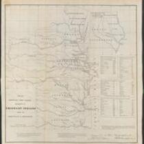
This 1836 black-and-white map depicts the lands assigned to emigrant Indians west of Arkansas and Missouri. The map was printed by Bowen and Co. Lithographers of Philadelphia.
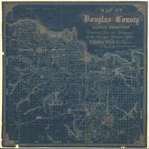
This map of Douglas County, Kansas Territory was drawn by I. Cooper Stuck in July of 1857. The map is marked with the locations of individual people's land claims.
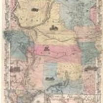
This color map, entitled “Nebraska and Kansas,” shows those two territories, the territory acquired from Mexico in 1854, and a small map of the continental United States. The map was published in 1854 by J.H. Colton and Co. in New York.
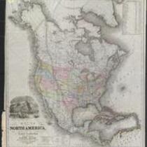
This black-and-white map is entitled “Map of North America, From the Latest Authorities Showing the Proposed Railroad Routes from the Atlantic to the Pacific Oceans.” The map was printed in 1854 by J.H. Colton and Co. in New York, for J. Disturnell.
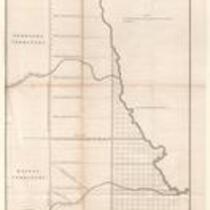
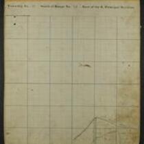
These 21 plat maps were made ca. 1857 by Isaac Cooper Stuck. The maps are marked with geographical features and locations of people’s land claims within the Shawnee Indian Reservation in eastern Kansas.